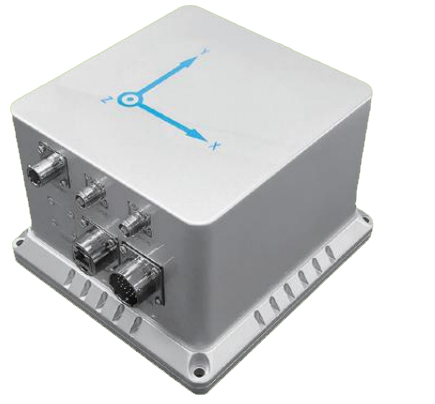

● Space stabilization platform, antenna system stabilization
● Attitude/orientation reference system, multi-beam attitude sensing
● Unmanned vehicle, unmanned aircraft, unmanned ship navigation and control
● Spatial stabilization platform, intellige
External GPS valid 4m baseline | North seeking accuracy (deg) | ≤0.25-0.1*Secant Latitude* |
Azimuth Accuracy(deg) | ≤0.05 | |
Attitude Angle Accuracy(deg) | ≤0.01 | |
Velocity Accuracy(m/s) | ≤0.03/RTK 0.01 | |
Position Accuracy(m) | ≤2m/RTK 2cm | |
GPS Invalid | Azimuth Holding Accuracy(deg) | ≤0.05, 1h |
Attitude Angle Holding Accuracy(deg) | ≤0.01, 1h | |
Position accuracy(km) | ≤3,1h ≤0.07,5mi | |
System Measurement Range | Azimuth Measurement Range(deg) | ±180 |
Attitude Measurement Range(deg) | ±90 | |
Environmental parameters | Operating Temperature(℃) | -45~+70 |
Storage temperature (℃) | -55~+80 | |
Vibration (Hz, g2/Hz) | 20~2000, 6g rms | |
Shock (g, ms) | 40,11 | |
Electrical Parameters | Input Voltage (Vdc) | +18~+36 |
Power (W) | 20 | |
Data Output Format | RS-422/RS-232 | |
Data Refresh Rate (Hz) | 100 | |
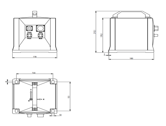
Physical parameters | Dimension (mm) | 178×180×179.1(handle not included) |
Weight (kg) | 6 | |
Connector | XCE12F3Z1D1;XCE24F26Z1D1 |


 +86 189 2129 2620
+86 176 0611 8008 sales@bwsensing.com


