Background
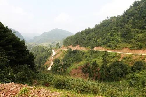
Ningqiang County is located in the southwest corner of Shaanxi Province,the intersection of Qinling Mountains and Bashan mountains. It’s the main gateway and golden channel for the intersection of north and south. The territory is high in the southeast and low in the northwest,and there is Wuding mountain uplift in the middle. The mountain area is wide, and the terrain ly presents "V" structure,divided into five geomorphic types: Valley Dam, valley, low mountain, center and high and medium mountain.
Ningqiang was seriously affected by the 2008 Wenchuan earthquake, which had a serious impact on the geological environment. After the earthquake, the risk of geological disasters increased significantly.It seriously affects the regional economic construction and the safety of people's lives and property. Therefore, it is urgent to strengthen the monitoring and early warning of geological disasters in Ningqiang.
Challenge
A. Complex terrain and geological structure cause frequent occurence of geological disasters,such as landslide, collapse, debris flow and ground collapse;
B. High precipitation intensity in the county,with frequent continuous rainfall and rainstorm;
C. The steep terrain and wide mountainous area make it very difficult for manual patrol and data acquisition
D. Poor timeliness and accuracy of traditional monitoring,difficult to carry out timely and effective early warning
The framework of our solution
Based on technical advantages, BWSENSING has built a set of “Geological disaster monitoring system solution” for key geological disasters, such as landslide, debris flow and collapse, so as to achieve "real-time monitoring, early warning, information management and auxiliary decision-making".
The geological disaster monitoring system is composed of a data acquisition sensor subsystem, a data transmission communication subsystem, a data processor release center subsystem, and an auxiliary support subsystem.
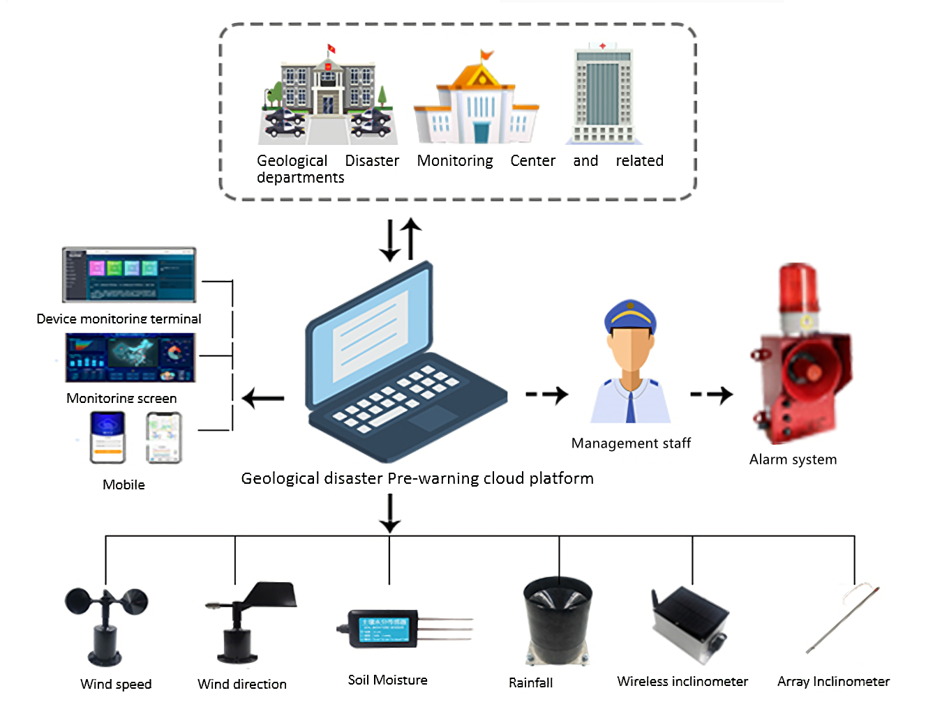
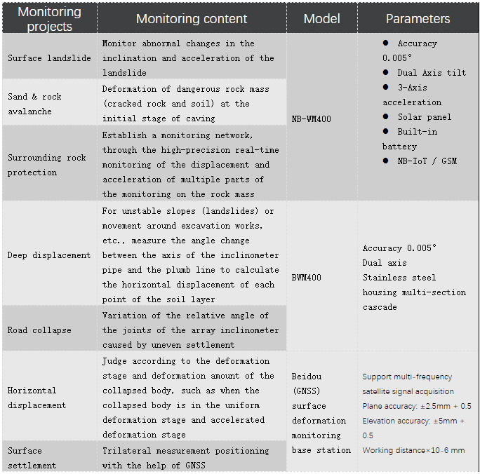
By monitoring the surface deformation, landslide thrust, groundwater level, precipitation of the potential hazard body, the relevant monitoring sensors are arranged for the potential hazard body, and the collected data are transmitted to the general data acquisition box. After the preliminary solution, it is uploaded to the cloud platform for remote on-line real-time monitoring, so as to predict the potential hazards and ensure the safety of people's lives and property.
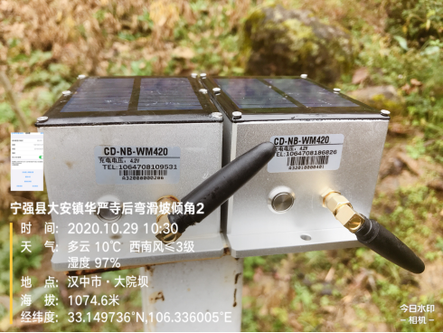
The core sensor of this scheme adopts NB-WM400 wireless inclination sensor independently developed by BWSENSING.It adopts rechargeable lithium battery, which can work continuously for 24 hours at a time.,can meet the needs of high-precision and high-frequency monitoring. It has remote control functions, can transmit data to the cloud by connecting to a wireless router.
In terms of network connection, It can be automatically disconnected and reconnected, which effectively avoid the problems caused by network abnormalities and server maintenance. The inclination unit adopts the latest technology MEMS, has the advantages of small volume, low power consumption, high consistency and stability.
Outcome
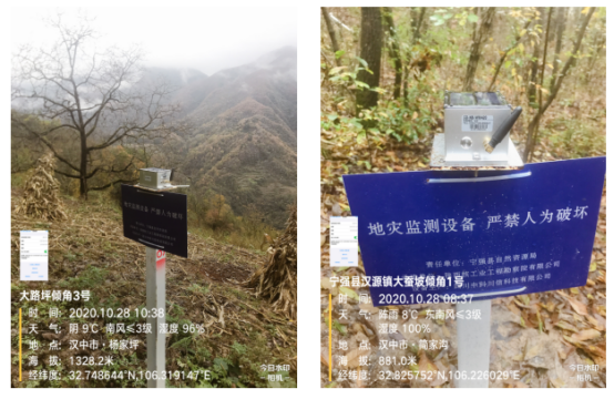
A. 7*24h all-weather monitoring, support unattended, greatly reduce the workload of manual inspection and reduce the monitoring cost
B. Accurate collection of monitoring data, and early warning of potential geological disasters , effectively avoiding or reducing the loss of life and property
C. Low power design, stable performance, easy installation, MTBF≥90000 hours,low maintenance cost
D. Automatically upload and accumulate monitoring big data to realize the scientization, standardization and visualization of disaster monitoring information, which provides an important basis for the analysis and decision-making of disaster prevention.

 +86 189 2129 2620
+86 176 0611 8008 sales@bwsensing.com


