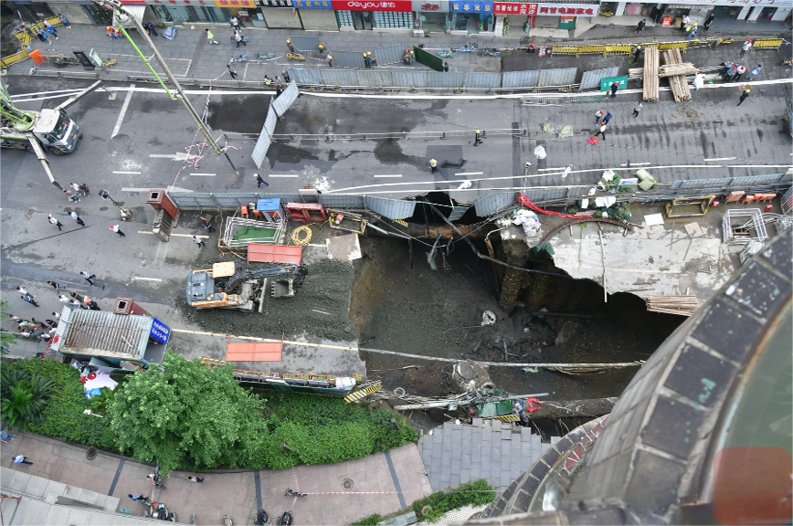
On June 21, 2024, a serious road collapse occurred on Jinli West Road in Chengdu, Sichuan Province, China. It is understood that the collapse site is located outside the construction foundation pit of Xiaonan Street Station on Line 13, and the collapse was caused by the natural burst of the water pipe. "And the Beijing News reporter learned from Chengdu Water Supply Co., Ltd. that the burst of the water pipe was caused by the sinking of the foundation in the subway construction site" (Source: Beijing News). Although the incident did not cause casualties, it had a serious impact on local traffic and aroused great attention from all walks of life to geological disaster monitoring.
According to the relevant content of the Chinese national standard "Technical Specifications for Monitoring of Urban Rail Transit Engineering" (GB50911-2013), geological disaster monitoring occupies an important position in urban construction and operation. The content of the surrounding structure monitoring in the specification mainly focuses on the safety status, change characteristics and development trends of existing rail transit facilities, buildings, underground pipelines and other environmental objects within the scope of the construction of urban rail transit projects:
Monitoring of existing rail transit facilities:
The monitoring content includes the track geometry status of existing rail transit lines, tunnel structure deformation, bridge structure displacement, etc.
Through regular and irregular monitoring, ensure the safety and stability of existing rail transit facilities during the construction of urban rail transit projects.
Monitoring of buildings (structures):
Monitor indicators such as settlement, tilt, and crack expansion of buildings within the scope of construction.
Especially for high-rise buildings, important public buildings, etc., it is necessary to increase the monitoring frequency and accuracy to prevent damage caused by construction.
Monitoring of underground pipelines:
The monitoring content includes the displacement, deformation, settlement, etc. of underground pipelines such as water supply, drainage, gas, heat, and electricity.
Through real-time monitoring, ensure the normal operation of underground pipelines and avoid pipeline damage or leakage caused by construction.
Monitoring of bridges and roads:
Monitor the displacement, settlement, cracks and other indicators of bridges and roads within the scope of construction.
Evaluate the bearing capacity and safety of bridges and roads through monitoring data to ensure the normal operation of traffic during construction.
In response to the Jinli West Road pavement collapse incident, experts emphasized that it is crucial to strengthen the monitoring of urban rail transit projects. Through scientific and standardized monitoring work, potential safety hazards can be discovered and resolved in a timely manner to ensure the safe operation of urban rail transit projects.
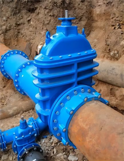
The "Jiangsu Province Urban Road Collapse Monitoring and Early Warning Guide (Trial) Release Version" issued by the Jiangsu Provincial Department of Housing and Urban-Rural Development clearly states:
Special monitoring targets key sections and uses professional instruments and equipment for monitoring. Key sections generally include:
1. Sections where pipelines along the route are prone to damage or serious leakage;
2. Sections around third-party construction;
3. Sections with soft strata and easy soil loss;
4. Sections with relatively developed shallow caves;
5. Sections near water with large traffic and pedestrian flow;
6. Sections with frequent collapse or dense hidden dangers;
7. Other sections with high collapse risk.
In this context, the micro-power multi-function geological disaster monitor CM500, wireless tilt sensor WM400 series products and GNSS displacement observation ball developed by BWSENSING have received widespread attention in the field of IoT structure monitoring.
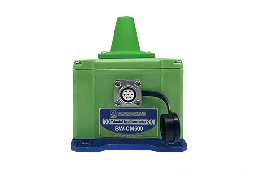
Micro-power multi-function geological disaster monitor CM500:
1. Support MQTT3.1.1 protocol: in line with the "Technical Requirements for Geological Disaster Monitoring Data Communication" of the Ministry of Natural Resources, it can obtain and transmit monitoring data in a timely manner and respond to potential disaster risks in a timely manner.
2. Low power consumption design: supports automatic sleep; supports timed wake-up and vibration wake-up, built-in large-capacity lithium-ion battery, can be used for more than 3 years without maintenance.
3. Can output three-axis inclination, axial plane angle, azimuth: more accurately judge the movement direction and amplitude of the geological body, enhance the reliability of the monitoring results, and improve the accuracy of the data.
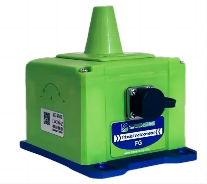
Wireless inclination sensor WM400 series:
1. Data stability: accuracy of 0.005°, resolution of 0.001°, with long-term stability and zero drift characteristics.
2. Multiple networks: support wireless/4G/LoRaWAN multiple gateway modes for data transmission.
3. Real-time warning: When the monitoring data exceeds the preset threshold, the system can automatically issue a warning and notify relevant personnel in time.
4. Easy to install: The equipment is small and light, easy to install, and has strong environmental adaptability, suitable for monitoring needs of various complex terrains.
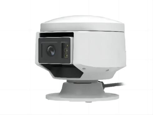
GNSS displacement observation ball:
1. Millimeter-level positioning: High-sensitivity GNSS omnidirectional receiving antenna integrates RTK technology, supports five-star sixteen-frequency, and obtains millimeter-level displacement data changes
2. Visual inspection: The industry's first video linkage review, integrating video perception and GNSS technology, micro-pan omnidirectional adjustment, and remote visualization.
3. One-stop application: low-power design, average power consumption less than 2W, remote automatic wake-up; support 4G/wired network transmission; RS-485 expansion interface, can be connected to external rain gauges, etc.; audio interface, can be connected to external sound columns, etc.; anti-corrosion material, suitable for open-air environments.
BWSENSING's intelligent sensing monitoring equipment has been put into use in many areas prone to geological disasters across the country, including Chengdu Qingbaijiang slope monitoring, Liaoyuan Mining open-pit coal mine slope monitoring, Shaanxi Ningqiang County slope monitoring and other projects, and has achieved remarkable results. By using advanced monitoring technology, relevant departments can grasp the geological conditions in a timely manner and take effective measures to prevent disasters.
The road collapse incident on Jinli West Road once again reminds us that the prevention and monitoring of geological disasters cannot be taken lightly. Society needs to further strengthen the monitoring of geological disasters and improve early warning and emergency response capabilities to protect the lives and property of urban residents.

 +86 189 2129 2620
+86 176 0611 8008 sales@bwsensing.com


